

Yesterday I did a one-day loop along the border of TN and NC. I’ve done all these roads before and camped in the area a lot, but for those who aren’t familiar, here’s a quick, interesting drive.
The Tail of the Dragon is well known among motorcyclists and sports car enthusiasts. For the rest of us, it’s a harrowing 11 mile stretch with 318 curves. However, it’s the only way to get over this first stretch of the Smokies south of Knoxville without going to the extremely crowded and touristy 411 through SMNP or going around the mountains to west in the Chattanooga area.
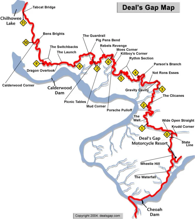
The road is US 129. It crosses from TN into NC. You’ll encounter a lot of motorcycles, many going too fast for their own good but there are plenty of quick turnouts to let them pass to their doom. However, the scenery for your passenger is great. As a driver you focus on the road. Going from north to south, if you follow 129 after you finish the Tail, you cross below the Cheoah dam.
Seventeen miles later, you reach the Cherohala Skyway.

Above is a drone shot from the summer. As you can see, a lot of turns. It’s higher, going up to almost 5,000 feet in places. Yesterday, the foliage above 4,500 was pretty bare, but below it was quite colorful. It runs to Tellico Plains.
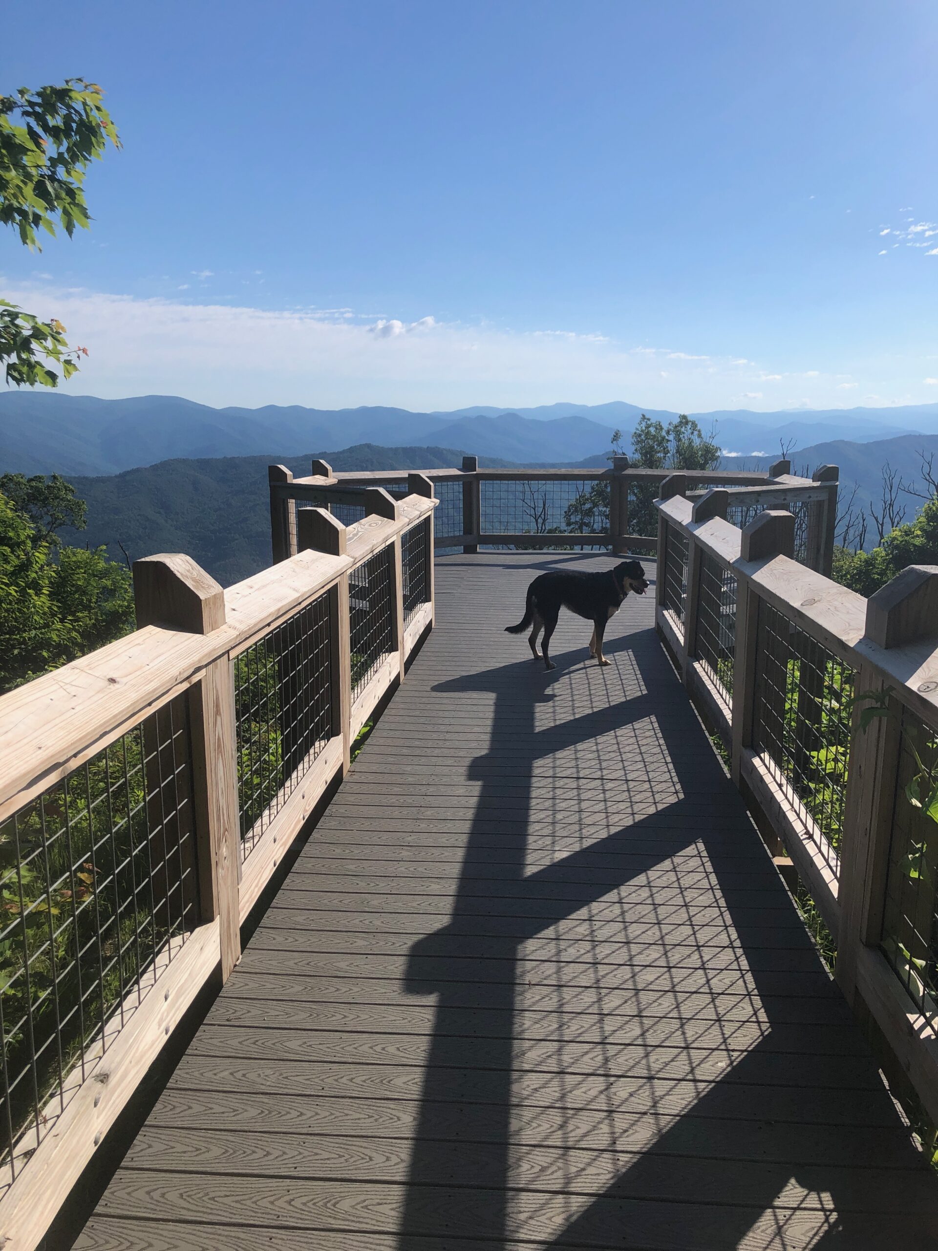
A couple of worthwhile detours. Just before the eastern start of the skyway, take the turn to Joyce Kilmer National Forest. You’ll come to a four-way stop. Straight ahead it says the road ends. It does, but at a beautiful overlook high up– the Maple Springs Observation Deck. During the last inauguration, there were clips of Native American dancers on the overlook platform. Here is Scout walking out onto the platform a couple of years ago when we had it to ourselves.
It’s a one way drive up and back down, but worth it.
Then you do the Skyway. If you prefer a straighter way, with no big views but a dirt road going along a stream, take Forest Road 81 which is off to the right where the Skyway starts. It’s also a way, if you are coming back, and want to try a different route.
Near the end of the Skyway, Forest Road 20 is a beautiful paved road running along Tellico River. You can go to Bald River Falls, which is well worth it. The road does continue south, but becomes unpaved and mountainous. But it does get through.
However, going east you follow the river until you come back to the Skyway and then Tellico Plains.
BTW the Appalachian Trail runs along the Skyway where it traverses the NC/TN border.
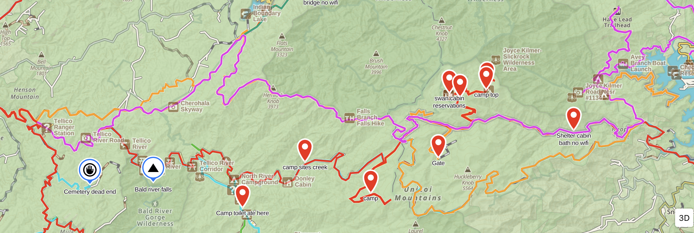
The above might be a bit confusing but it’s a screenshot of my GAIA map with various waypoints marked from other trips surrounding the Skyway. The overlook is top right where it says Trailhead. The Skyway is yellow and then pink. The right side pink is the forest road. The red below the pink to the left is the other forest road. You see Bald River Falls near the left end.
Which brings me to the point that I highly recommend the Gaia app. Basic is free, but you get a 20% discount with this: https://www.gaiagps.com/discounts/?fp_ref=bob-94
Unless you’re out west in BLM land, I’ve found this area of the Appalachians with its cluster of National Forests and Wildlife Management Areas around the TN/GA/NC triangle to be the best for dispersed camping–outside of Smoky Mountain National Park which is crowded and full of rules! There are tons of Forest Roads. Try The Georgia Traverse for Forest and Off-Road Road Enthusiasts
Here is some advice on that:
How To Find Places To Disperse Camp W/Vehicle
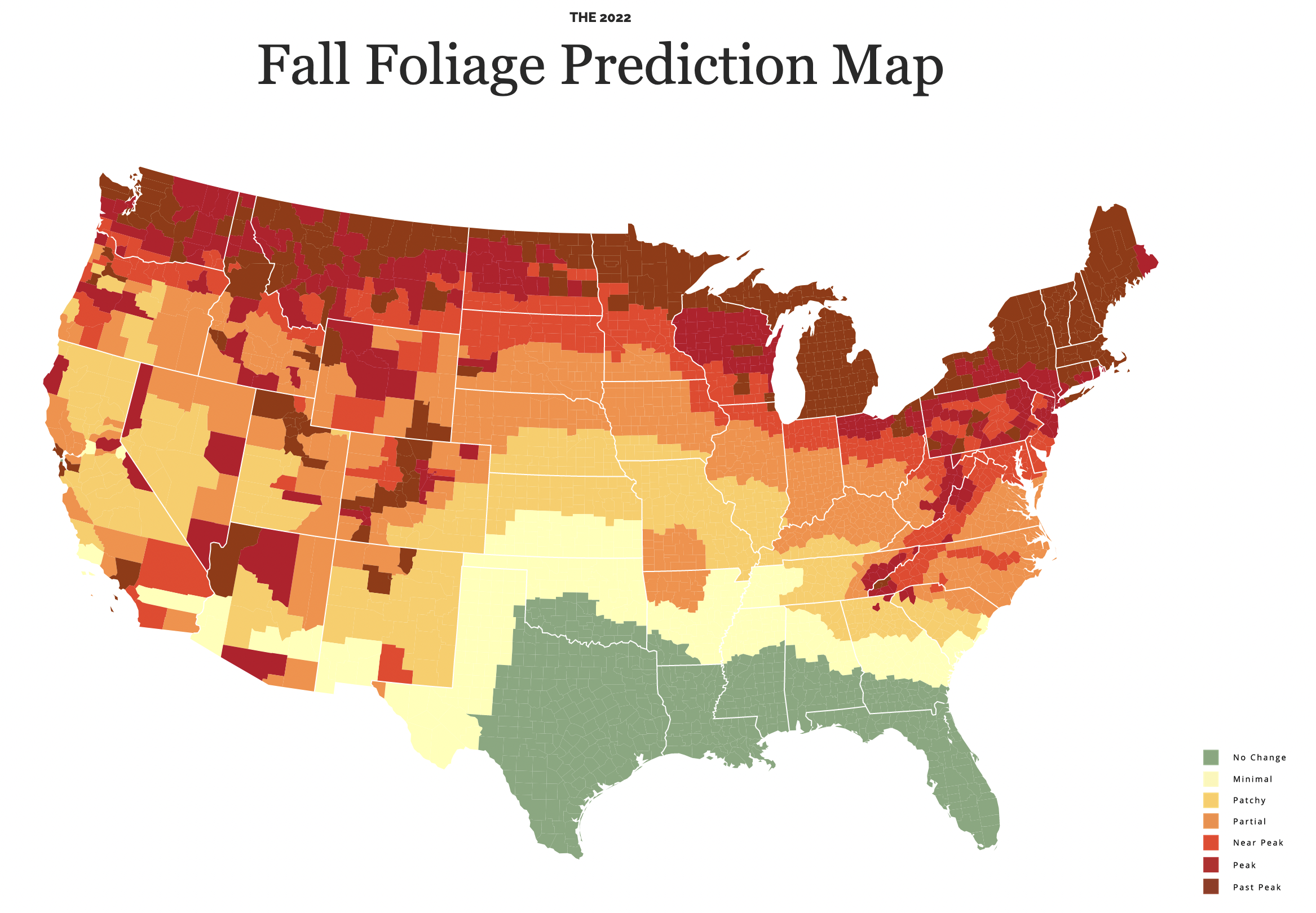
Here is the current stage of foliage change:
Enjoy and stay safe!
Recent Comments