
Have You Ever Built a Fire?
Unless you’ve actually done it, starting a fire seems easy. I see so many movies and shows where people get a fire going with no problem. Roaring blazes that last forever. Torches that burn indefinitely.
The reality is, fire starting, especially in a survival situation, or even just camping, is a lot harder than it appears.
While I have field expedient ways of initiating a fire in my survival book, they are extremely difficult. It’s much easier to have lighters and matches in your car, grab-n-go bags and small survival caches. When I deployed, I carried several lighters on me in various places.
Some caveats on fire starting. Make sure whatever you start doesn’t get out of control. Fire is our friend until it becomes our enemy.
There are keys to starting any fire. First is gathering the proper flammables. They should be dry. If your environment is damp or wet, search for dry material under hanging rocks, under logs, or even gather damp material and put inside your shirt to use your body warmth to dry it out. Breaking damp sticks should expose a dry portion. Don’t use soggy or rotten wood.
You need three piles:
Tinder: Dry, flammable material that needs only a few sparks to ignite. Thin, fibrous plant material. Fine steel wool. Tinder is easy to ignite but does not sustain fire. So you need . . .
Kindling: Slightly larger organic material that feeds the fire initially. Dry wood chips, twigs, dry strips of bark, dry grass stalks, refuse such as paper.
Firewood: Thicker branches and logs take longer to ignite, but once they do, they sustain the fire longer.
Field expedient ways:
Hand drill: This field expedient way to build a fire is also the most labor intensive. Use a piece of hardwood as the fireboard. Make a notch in it with a knife or pointed rock. You need a two-foot-long stick whose tip fits into the notch. Surround the notch with tinder. Roll the stick between your palms (wear gloves if you have them), causing friction. Enough friction causes heat. It will start smoking and ignite the kindling. Slowly add kindling to build the fire.
Mirror/Glass: This requires two items. Sunlight and a parabolic mirror or lens. The reflector of a flashlight, or the clean inside of a soda can cut open are possibilities in a pinch. A clear bottle filled with water can also work. Anything that can focus the rays of the sun. Direct the focus sunlight on the kindling.
Honestly, when I go camping/boondocking I take Duraflame logs, and cut them in quarters. A quarter of one of those logs is one of the easiest fire starters around. I carry them on my Gladiator in a hose carrier bolted on my rack—they fit perfectly when separately wrapped inside a small plastic shopping back.
Sustaining a long term fire: keep the flames going. If a fire burns down to embers, you use the core of that to restart the fire, using the same flow as starting a new fire: tinder, kindling, firewood. Tossing firewood on embers could disperse the embers and cause you to start over again.
I recommend anyone serious about preparation, practice starting a fire outdoors, even if you just use a lighter to start it. You’ll find it a bit more difficult than you expect but with practice you can get better.
Actually, that’s something we all need to do with all gear, even if we’re just going camping. Set up that new tent at home for the first time, not out in the wilderness. Use every piece of emergency gear, from water filters to radios at least once before having to use it in an emergency. Use your emergency Apps at least once before needing them. You don’t want to have figure it out in the actual emergency
Partly excerpted from The Green Beret Preparation and Survival Guide
Also from a free slideshow at www.bobmayer.com/workshops
Book of the Day: Omega Missile. A single missile controls our entire nuclear arsenal and . . .

The original idea for this book came from my son, who wondered what would happen if a natural disaster occurred at a nuclear missile base. Say an earthquake hitting a launch control center?
When I was in 10th Special Forces, we occasionally tested security at various installations. One time we hit the Alaskan Pipeline, which was the basis for my first manuscript which ended up being Dragon Sim-13. We also tested the security at Plattsburg Air Force Base which at the time had F-111s and bunkers holding nuclear warheads. So I dug into security at missile bases around the country.
I found an intriguing little thing. There was an ICBM that instead of holding a nuclear warhead, held a powerful transmitter. It would be launched and then deploy the transmitter. Which would then transmit the launch codes for all arms of the nuclear triad.
Well. What a perfect target.
And that I show Omega Missile came into being.
It’s part of my five-book Shadow Warrior series but all five books are stand alones so you can read them in any order.
Omega Missile is available on all eBook platforms.
Book of the Day: Nightstalkers. The Unit Meets Warehouse 13

Branching off from serious military thrillers and the other extreme of epic science fiction, I wanted to write something a bit more fun and personal. Having been in Special Operations, I considered what a team would be like that dealt with things that go bump in the night. The weird. The supernatural, but in a scientific way. Most importantly, deal with the mistakes of scientists who sometimes lose track. After all, the most powerful weapon ever, the nuclear bomb, was invented by scientists.
As always, I did research. And I found out about the Demon Core at Los Alamos when they were developing the atomic bomb. Then I did what fiction writers always do. Ask what if?
I came up with Rifts, tears in space-time, opened by the Demon Core. And a unit is formed to deal with what comes through, called Fireflies. These can take over animate and inanimate objects. And wreak havoc. Such as killer rabbits. A swimming pool that attacks. And more.
I love the members of the Nightstalkers, who alert ring tone is Lawyers, Guns and Money by Warren Zevon.
This is the first book of one of my favorite series, with a special character, Scout. The Nightstalkers are in several books and then evolve into being the Time Patrol in that series of books.
I hope you enjoy as Moms, Nada, Scout, Kirk, Doc, Roland and the other members of the team take you on a journey fighting fireflies and saving our world!
The Nightstalkers is also available in Kindle Unlimited.
AllWhoWander: Road trip review: From Knoxville to Monument Valley Avoiding Interstates

Interstates are a necessary evil. You can get from here to there in your auto fast. But they’re numbingly boring. And you’re competing with a lot of eighteen-wheelers. I do everything possible to avoid them unless under a time crunch.
I’ve even read a book about how the Interstates came about: The Big Roads: The Untold Story of the Engineers, Visionaries, and Trailblazers Who Created the American Superhighways. An interesting story going back to the history of autos. We don’t think about it, but we had cars before we had the roads to drive them on. Which was a problem.
I knew about Eisenhower and his cross-country army convoy early in his career. And the Zero Milestone is featured in The Jefferson Allegiance—a still warm heart cut out of a person ends up on it. You’ll have to read the book.
I recently did a western Wander from Knoxville with my goal being Monument Valley. I could have taken I-40 across TN, AR, OK, the panhandle of Texas and New Mexico and up. A bit longer would have been I-70 and then SW across Colorado to Four Corners.
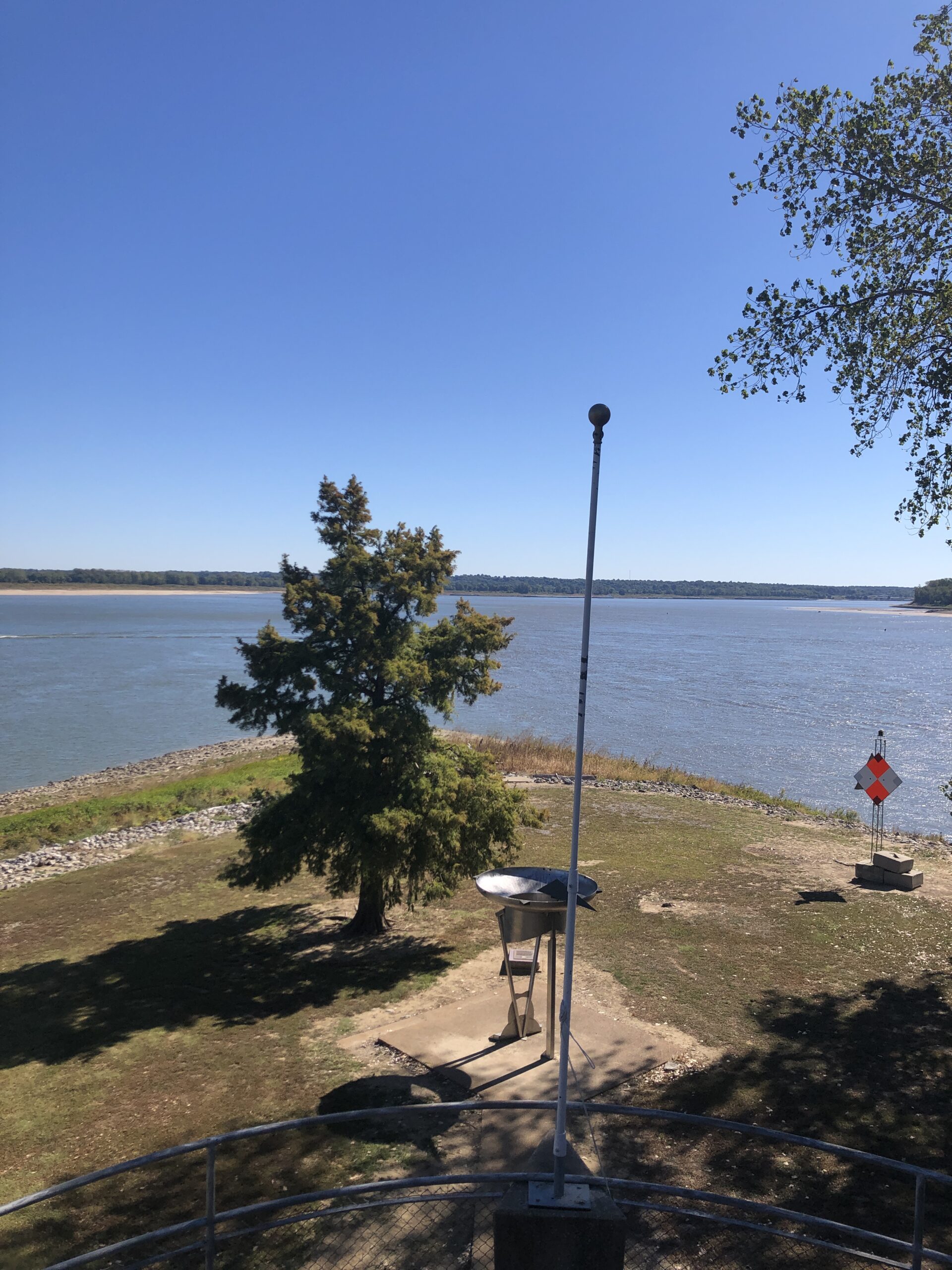
Instead, I chose to do I-40 Nashville (there really aren’t many options across middle TN), then I-24 to Paducah, and from there Route 60 west. That crossed the Ohio and Mississippi Rivers at Cairo, right where they joined on two rickety two-lane bridge. I stopped there, on the point of land where Lewis and Clark camped to learn celestial navigation before their trip west and U.S. Grant seized to control the upper reaches of the rivers. The park there is worth the stop, right after crossing the Ohio and before crossing the Mississippi.
From there, Route 60 goes across the southern part of Missouri. Then into Oklahoma.
Whenever I head west, I find a dearth of spots to disperse camp due to the lack of National Forests and BLM land. Oklahoma has an excellent state park web site where you can reserve your camp site on-line. Be aware that in-season, the weekends are almost always fully booked. I hit OK state campgrounds on the outward and return trips for one night each. At $16 a pop, it isn’t bad.
I have to honest and say the drive across OK, and you drive across the entire length of OK including the dust bowl area, is boring as heck. But so is across Kansas or CO. Or across TX. It’s going to the high plains. Choose your poison. The eastern forests start disappearing as you traverse eastern OK.
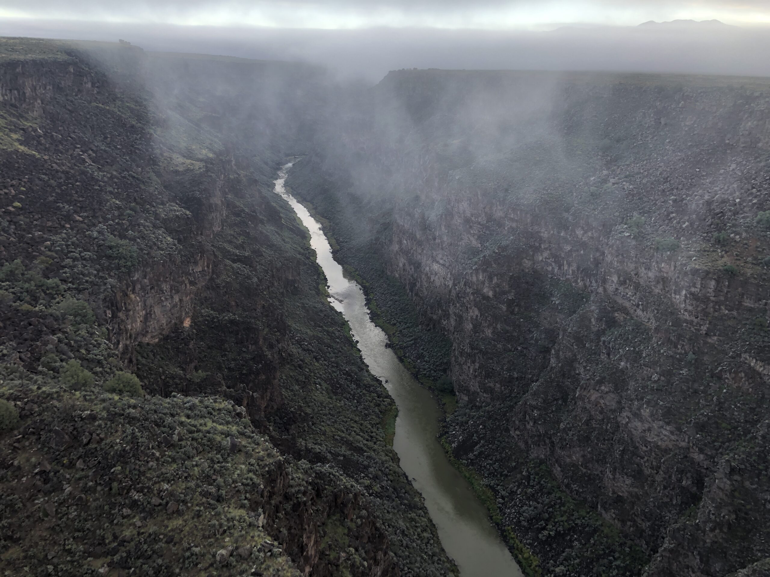
I switched from Route 60 to Route 64 not long after crossing the north-south I-35. Route 66 even joins 64 for a little while. Other roads also join it, but 64 keeps heading west. Once you cross I-25 you’re in the foothills of the Rockies and there are plenty of National Forests to boondock in. I passed through Cimmaron, NM, then Eagle Nest. I camped in a campground in the mountains between Angel Fire and Taos. The next morning, I passed through Taos, still on 64. I hit dense fog on the plain northwest of Tao, passing over the Rio Grande Gorge, which is pretty spectacular. Worth a stop in the parking area on the western side and walk out onto.
Eventually going through Dulce, where I had been before doing research many years ago for my Area 51 books. There is a government facility near the town with various stories attached to it. I made up my own. Because. I can.
Then across northern NM, one of my favorite parts of the country. I finally left Route 64 to go to Four Corners. I’m glad I took this longer loop. Before I’d left for Monument Valley, I’d looked at some sites about boondocking in the Monument Valley area. Several mentioned Valley of the Gods, but I couldn’t find it on the map. As I was coming down 163 toward Monument Valley, I saw a small sign to the right indicating Valley of the Gods. I turned off and was glad I did so. There’s a 17-mile loop of unimproved dirt road in the Valley. And that is another post coming this week, contrasting VOG and Monument Valley.
Anyway. Basically Route 64 to Route 60 and avoiding the Interstate. I recommend it. Even Oklahoma.
How To Find Places To Disperse Camp W/Vehicle https://link.medium.com/5ingSqa7Jjb #hiking #camping #Jeep #JeepLife #boondocking #travel
AllWhoWander: Road trip review: Parsons Branch Road Out of Cades Cove; Smokies
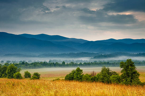
Cades Cove is one of the top destinations in Smoky Mountains National Park. Because it is indeed beautiful, especially early in the morning. But because so many people go there, and it’s basically an 11 mile, single lane, one-way loop around the Cove, expect there to be long lines.
And, unfortunately, a lot of people who don’t understand other people exist. They’ll stop to look at something and not pull into one of the many pull outs, blocking traffic for as long as they wish. Especially if they spot a bear, which is common. The speed limit is 20 but you’ll end up behind someone going 5 miles an hour the entire way, not showing the courtesy of pulling over.
My recommendation is to go off-season or, if in-season, do Wednesday or Sunday mornings when the Cove is closed to cars from 6 to 10 am so people can bike it. Be warned, though. It’s a harder bike ride than you might expect for 11 miles. I do a lot of biking and am always a little surprised at the sharp, hard uphills. You can check the web site for the in-season, usually May to the end of October for these closures.
In season for the crowds is spring through fall. Winter isn’t crowded.
Personally, I prefer to go other places in the mountains. In essence, everyone visiting the Smokies goes to Cades Cove and/or Route 441 through the mountains. I’ll do another post for AllWhoWander with other beautiful, hidden options in the area.
During the pandemic, when I did a lot of wandering and found places empty, I tried to do Parsons Branch Road which comes out of the far end of Cades Cove to the middle of the Dragons Tail on Route 129. But since the NPS was on skeleton crew, the road was closed due to trees down. Much like Swan Cabin was.
They re-opened it for the season, which ends 13 November, so I braved the long line of tourists going around the park and then took the turn off for Parsons Branch, which was nice because I was the only one. The signs are ominous—require high clearance, one-way, yada yada.
Frankly, I think most cars could easily do it. You do cross several streams and we’re in a bit of a drought here so the water would be higher, but still not that bad. I didn’t even go into 4WD at any time in the Wanderer.
Honestly, it was a typical forest road. Nothing of note, no great views. You can find the same throughout the mountains. It is a nice away to get from the Townsend area to 129 without looping all the way around on Foothills Parkway, but it’s actually slower because of the tourists rubber-necking in Cades Cove.
I checked it off my list and enjoyed the quiet and solitude after the crowds in Cades Cove. When you reach 129, you’re closer to the NC end of the Dragons Tail. Which is left. Turn right and you are in TN and toward Foothills Parkway. Or stay on 129 and you eventually end up in Knoxville after passing through Maryville.
There is no cell phone reception as soon as you start into the Smokies toward Cades Cove, in the Cove, on Parsons Branch road and Tail of the Dragon.
Stay safe!
Alpha: Eddie Gallagher and the War for the Soul of the Navy SEALs. A Review
This was a very depressing book to read. It also should be required reading for all involved in Special Operations, especially the Navy Special Warfare community.
If you think you know what happened in the Eddie Gallagher case, you probably only know the tip of the iceberg. The rest is what is even more depressing. Particularly how, at a national level, we have an entire section of our country living in an alternate reality where facts don’t matter, only the spin and the lying and grift. Eddie Gallagher is in that part. On a personal level, he was a part of it before the events in Iraq.
All of us who’ve served have met his type. A slick talker, tough-acting, bullshitter. Who at his core is scared. The danger is that he was responsible for others and put them in harm’s way. The worst kind of leader. On top of that, as a result of his terrible actions, he became a figurehead for those like him. I recently saw a picture of him with a police SWAT team (I spent some time doing that) and have to wonder what he taught them. He’s the last guy I’d want teaching police.
Having worked with SEALs on operations and commanded a Special Forces A-Team with a maritime operations specialty (we graduated the Royal Danish Navy combat swim school where we learned “dry suits aren’t”) I have some idea how small special ops units operate. And there is a world of difference between SEALs and Special Forces. Not just our missions, but our culture.
I met Dick Marcinko several times, all after having read Rogue Warrior which put me on notice. That was a book I didn’t like. Why? Because I thought his leadership philosophy was toxic. He put “his way” above the Navy’s way. He was the law. No leader is the law. We were put together by our agents to write together but I couldn’t do it. Our philosophies were too divergent. I found it fascinating that we did a book signing sitting side by side and didn’t even speak to each other. Sometimes that gulf in attitude is so large it can’t be crossed. Then again, maybe I’m just an asshole
Bernie Kerik, who is in the book, called me to talk about ghostwriting for me and concluded he didn’t feel any connection, which I take as a compliment from a convicted felon. As an aside, I’m stunned that a major “news” channel has so many convicted and accused criminals on as pundits.
SEALs are outside the mainstream Navy; pretty much a world apart. Special Forces is outside the mainstream Army, but it’s a growth from out of the Army, not a world apart. An SF Team leader at the very least has commanded a platoon. I commanded three before I went through the Q-Course and then was assigned to Group and took over a team.
As the only officer and in command, I was also one of the least experienced in SF on the team. I had to trust my Team Sergeant and other NCOs for their expertise and input. BUT, I was still in command. The bullshit stopped with me. The responsibility was mine. Not the Team Sergeant’s or the Warrant’s. In one year’s time I saw three team leaders relieved of command, their army careers over, because they didn’t LEAD.
The fact none of the officers in Gallagher’s chain of command stepped up as he constantly not only violated orders, but pursued dangerous tactics and didn’t even really lead is highly disturbing. It’s also endemic in the SEALs. Their junior officers defer to the senior enlisted beyond the point of responsibility.
This book shows the danger of that. It also lays out the schism in the ranks of the SEALs between the “pirates” and those who do their duty with honor, dignity and courage. There are many more of the latter than the former. But the former get all the news for better or worse.
We also have to accept that the operational tempo of the infamous WOT was unsustainable, especially for Special Operations with constant deployments. It took its toll on the psyches and the bodies. I do blame our civilian leadership on both sides of the aisle for having no clear guidance. I blame our flag officers in that not a single one took a stand on something like Afghanistan and said “We have no mission. No clearly attainable goal that will signify when this mission has been achieved.” They all bullshitted their way through their commands and their crimes are greater than Eddie Gallagher’s.
Regardless, I’m not sure the problems exemplified by Eddie Gallagher have been resolved. It will probably take a generation.
This book is highly recommended and very well-researched.
Alpha: Eddie Gallagher and the War for the Soul of the Navy SEALs. A Review
Publication Day: Phoebe and the Traitor; Shane free and more

Out 10 days early as a Halloween treat, Phoebe and the Traitor is out in Kindle, Kindle Unlimited, trade paperback and hardcover.
The prequel, Shane and the Hitwoman is free on Kindle and Kindle Unlimited.
Also for Halloween, Hallows Eve is free. Six Time Patrol missions on Hallows Eve, from Martin Luther posting, to the Reuben James being torpedoed over a month before Pearl Harbor, to Shaka Zulu, to the Salem Witch Trials and Gandhi’s assassination. What if something changed in those?
For those of you who are writers or might be doing NanoWrimo, The Novel Writer’s Toolkit is only .99 or Kindle Unlimited. And The Writer’s Little Black Book is free.
And lurking on the horizon, hopefully publishing in 2023, are three collaborations with Jennifer Crusie. A trilogy starring Liz Danger and Vince Cooper. Titles are:
Lavender’s Blue
Rest in Pink
One in Vermillion
I’ll update the web site and send out a newsletter once we get an idea of how and when they will be published, but they are all done.
We hope everyone is enjoying a great fall! Maggie certainly is.
Bob & Scout & Maggie

What Were The First Two Iterations of Madison Square Garden?
I remember watching Led Zeppelin’s last concert in the current Garden from ‘Blue Heaven’. Also attending the Millrose Games when they were held at the venue. My sister had season tickets to the Knicks and suffered through the oh-so-close, but never there, Patrick Ewing/Pat Riley era.
One confusing aspect of Madison Square Garden is that the current iteration isn’t located in Madison Square but rather Pennsylvania Plaza. One of those weird things that has history because the first, and second, Madison Square Garden were located, appropriately enough, in Madison Square.
The Garden came into being because P.T. Barnum set up his circus in an abandoned rail depot just north of Madison Square that was owned by Commodore Vanderbilt starting in 1873. Eventually, Vanderbilt built an arena in 1879.

The building, however, wasn’t built to last and was torn down in 1889. However, the circus was so profitable, a second arena was built. To avoid missing more than one season, workers labored around the clock, and it opened in 1890. Upon completion, it was the second tallest building in the City.
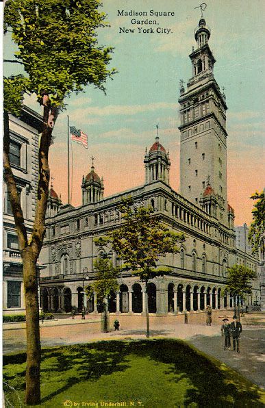
It was a massive building for the time. The tower was 32 stories high. The interior hall was the largest in the world. Spanning by 200 feet by 350 feet it had seating for 8,000 and room for more to crowd in. The cost of construction was a whopping 3 million.
Seventeen thousand people attended the opening, including one of my favorites, General William Tecumseh Sherman. The builder of Garden II, kept an apartment in the tower where he had a “love nest.” This turned out not to be such a great idea because he was trapped and murdered on top of the building by the jilted husband of a young actress he seduced there. Always have an escape route from jilted husbands. Which I did not cover in The Green Beret Area Study Workbook. My bad.
Despite that dark cloud, the second Garden hosted a number of significant events. An indoor marathon was hosted in 1909. I used to run indoor track at the 168th Street Armory. And have run marathons, but I can’t imagine running an indoor marathon, The number of laps would be mind-numbing. But five thousand people showed up for it and the winner ran an indoor record of 2:54:45.4.
The Millrose Games were first held there in 1914. The Wanamaker Mile was always the highlight of those games which stayed in the Garden until 2011. Where it moved to where I ran indoors in high school, the 168th Street Armory. But a greatly improved armory from the splintered flat wooden floor I ran on where the track was marked by lengths of wood on the inside curves.
The Garden also started hosting the Westminster Kennel Club dog show, which is the second longest running US Sporting Event, behind the Kentucky Derby. No word when Christopher Guest showed up for the first time with his hound.
Boxing was illegal early on, but that didn’t stop promoters. They were billed as ‘illustrated lectures’, which is one way of putting it. Wrestling and bicycling also were featured.
Garden II was owned by the New York Life Insurance Company and the bean counters finally decided it wasn’t profitable enough and it was torn down in 1925 and replaced the New York Life Building.
Excerpted from: New York City Little Black Book 1: Secrets, History, and Trivia of the World’s Greatest City.
Where Was the First European Settlement In New York City?
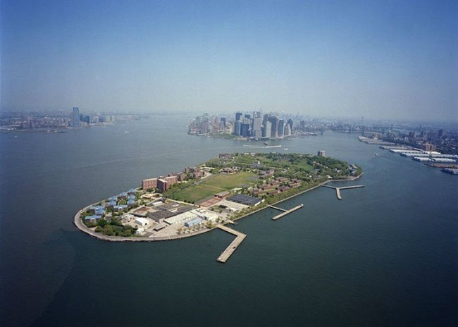
New York City was not where the first Europeans settled in the area. They bypassed it. Maybe they knew something?
The reality is that the area was heavily populated by Native Americans. Oyster beds in the harbor, long since destroyed, were bountiful and helped sustain a large number of inhabitants.
While the English settled Jamestown in 1607 and Plymouth in 1620, the Dutch established a trading post, Fort Orange, in the vicinity of Albany in 1614 bypassing the New York City area. Fort Orange was five miles south of where the Mohawk joins the Hudson River.
Ten years later, in May, 1624, 30 families landed at Governor’s Island in New York harbor. This was the beginning of New Amsterdam.
Some eventually moved to Manhattan Island.
They chose the island first because they were greatly outnumbered by Native Americans in the area, and it wasn’t encroaching on their land as much and more easily defended.
The original island was much smaller than the present one, given there have been lots of landfill over the years, much like the shoreline of Manhattan.
Governors Island was called Paggank by the native Lenape, translated at Nut Island. Perhaps they had an idea of who would be living in the city?
Excerpted from: New York City Little Black Book 1: Secrets, History, and Trivia of the World’s Greatest City.
A Recommended Fall Foliage Trip: Dragon’s Tail and On

Yesterday I did a one-day loop along the border of TN and NC. I’ve done all these roads before and camped in the area a lot, but for those who aren’t familiar, here’s a quick, interesting drive.
The Tail of the Dragon is well known among motorcyclists and sports car enthusiasts. For the rest of us, it’s a harrowing 11 mile stretch with 318 curves. However, it’s the only way to get over this first stretch of the Smokies south of Knoxville without going to the extremely crowded and touristy 411 through SMNP or going around the mountains to west in the Chattanooga area.
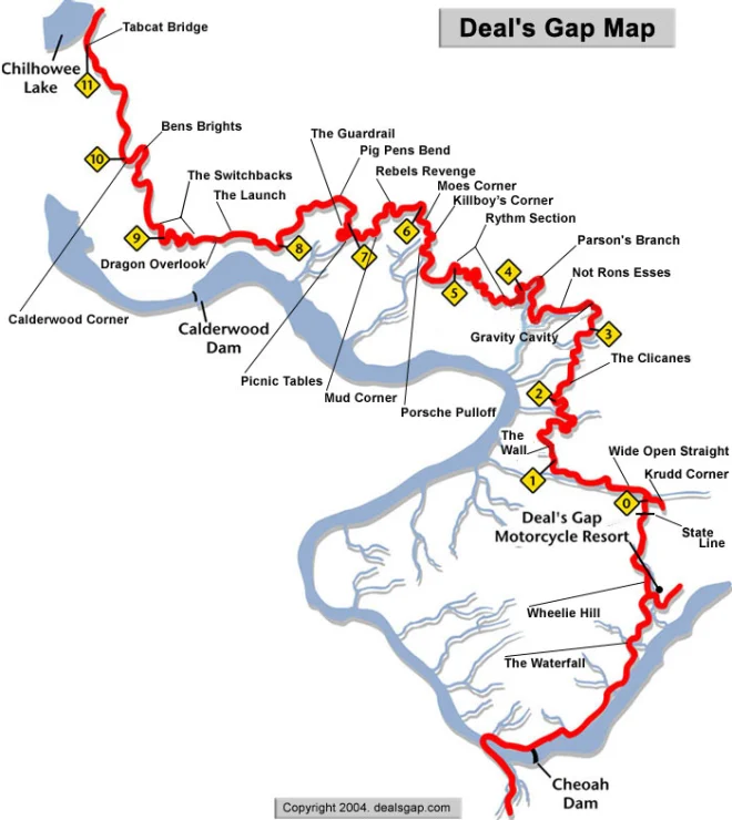
The road is US 129. It crosses from TN into NC. You’ll encounter a lot of motorcycles, many going too fast for their own good but there are plenty of quick turnouts to let them pass to their doom. However, the scenery for your passenger is great. As a driver you focus on the road. Going from north to south, if you follow 129 after you finish the Tail, you cross below the Cheoah dam.
Seventeen miles later, you reach the Cherohala Skyway.

Above is a drone shot from the summer. As you can see, a lot of turns. It’s higher, going up to almost 5,000 feet in places. Yesterday, the foliage above 4,500 was pretty bare, but below it was quite colorful. It runs to Tellico Plains.
A couple of worthwhile detours. Just before the eastern start of the skyway, take the turn to Joyce Kilmer National Forest. You’ll come to a four-way stop. Straight ahead it says the road ends. It does, but at a beautiful overlook high up– the Maple Springs Observation Deck. During the last inauguration, there were clips of Native American dancers on the overlook platform. Here is Scout walking out onto the platform a couple of years ago when we had it to ourselves.
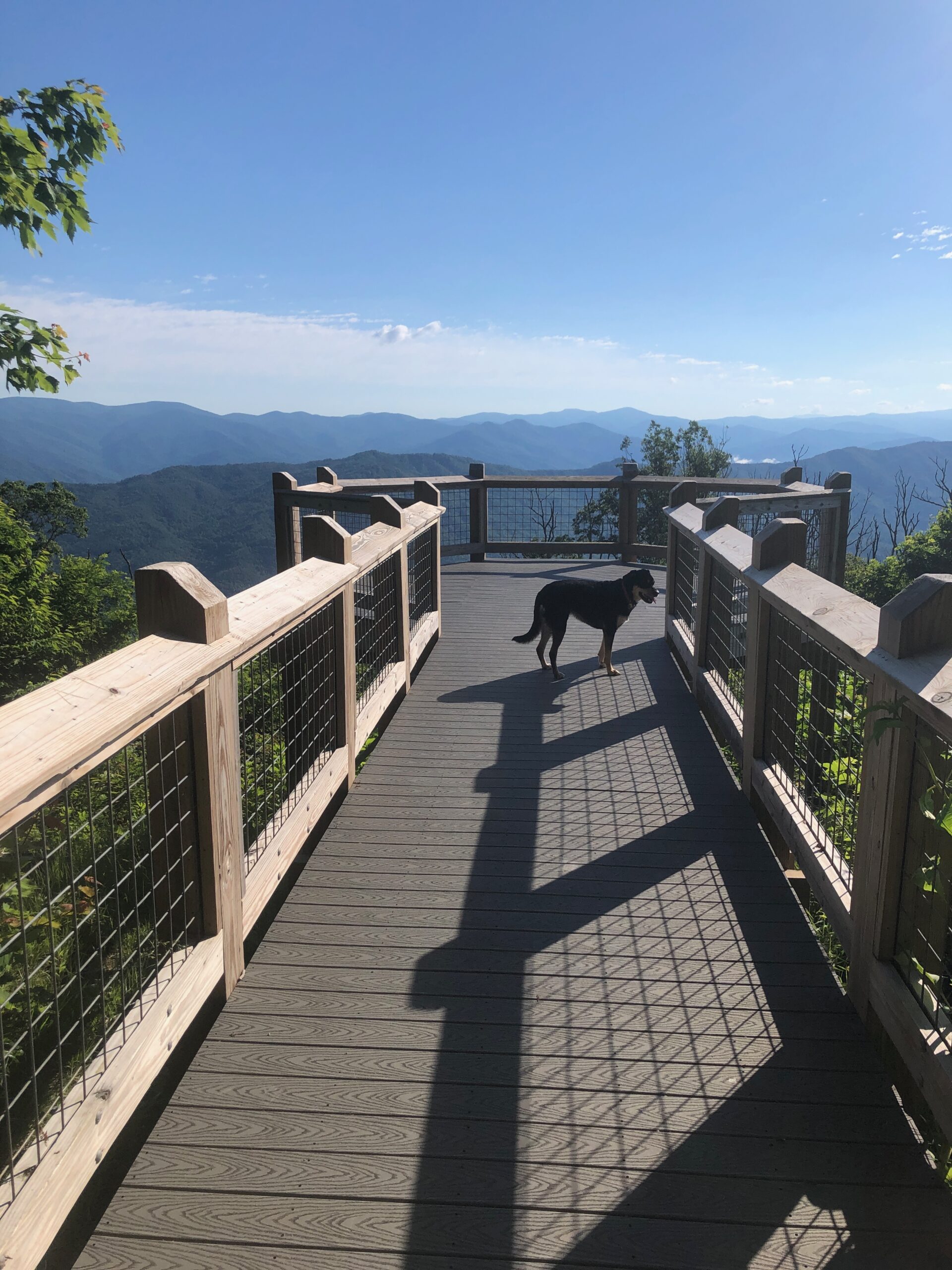
It’s a one way drive up and back down, but worth it.
Then you do the Skyway. If you prefer a straighter way, with no big views but a dirt road going along a stream, take Forest Road 81 which is off to the right where the Skyway starts. It’s also a way, if you are coming back, and want to try a different route.
Near the end of the Skyway, Forest Road 20 is a beautiful paved road running along Tellico River. You can go to Bald River Falls, which is well worth it. The road does continue south, but becomes unpaved and mountainous. But it does get through.
However, going east you follow the river until you come back to the Skyway and then Tellico Plains.
BTW the Appalachian Trail runs along the Skyway where it traverses the NC/TN border.
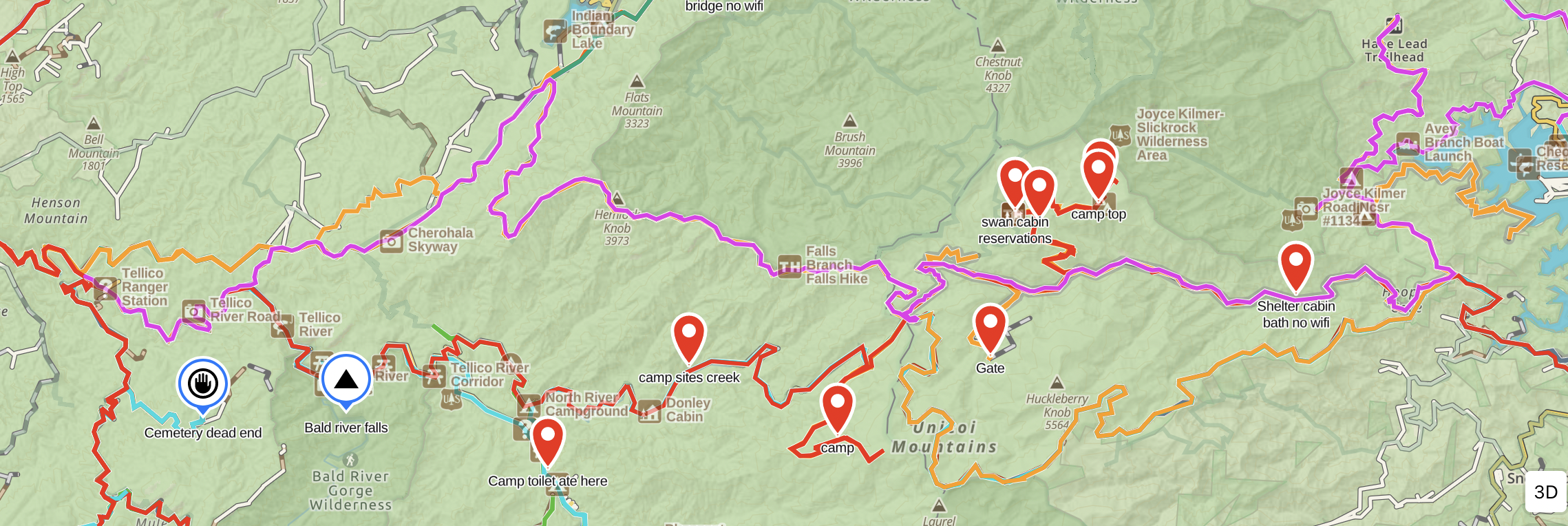
The above might be a bit confusing but it’s a screenshot of my GAIA map with various waypoints marked from other trips surrounding the Skyway. The overlook is top right where it says Trailhead. The Skyway is yellow and then pink. The right side pink is the forest road. The red below the pink to the left is the other forest road. You see Bald River Falls near the left end.
Which brings me to the point that I highly recommend the Gaia app. Basic is free, but you get a 20% discount with this: https://www.gaiagps.com/discounts/?fp_ref=bob-94
Unless you’re out west in BLM land, I’ve found this area of the Appalachians with its cluster of National Forests and Wildlife Management Areas around the TN/GA/NC triangle to be the best for dispersed camping–outside of Smoky Mountain National Park which is crowded and full of rules! There are tons of Forest Roads. Try The Georgia Traverse for Forest and Off-Road Road Enthusiasts
Here is some advice on that:
How To Find Places To Disperse Camp W/Vehicle
Here is the current stage of foliage change:

Enjoy and stay safe!
Recent Comments